Master Plan Model: A Comprehensive Guide to Urban Planning, Architectural Visualization and Smart City Scale Models
Introduction
A well-planned development needs more than individual buildings, roads, open areas, and landscape spaces. Architects and planners also need to understand how these elements connect and work together. They need to see how people move through the development, how different zones connect, and how the project can grow in the future.
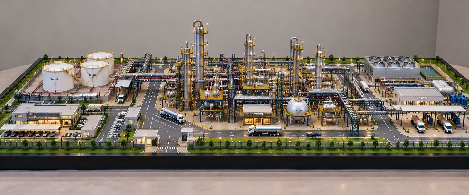
A Master Plan Model gives a clear three-dimensional view of the complete development. It brings residential areas, commercial spaces, recreational zones, roads, water features, landscape areas, high-rise buildings, villas, pedestrian paths, and important architectural features into one physical presentation.
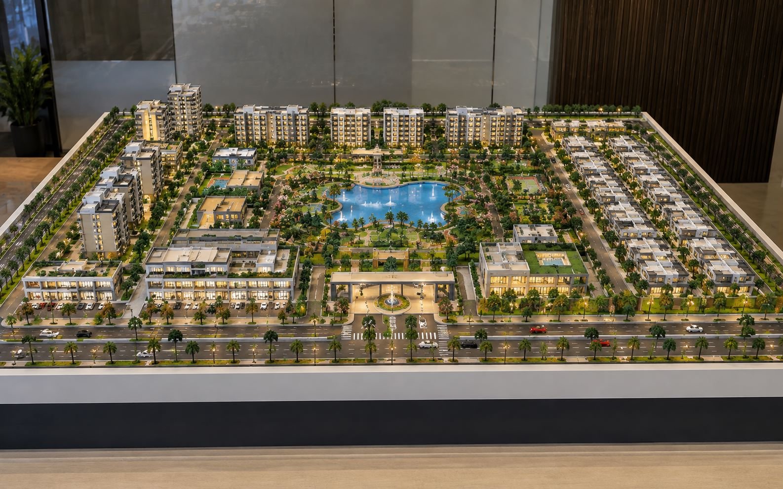
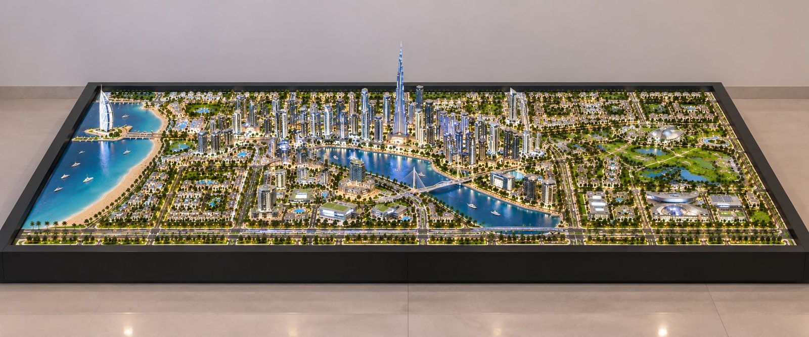
The featured model shows a modern urban development with waterfront areas, high-rise buildings, landscaped communities, recreational spaces, roads, bridges, and future city planning. The model presents these elements together and helps viewers understand the relationship between different parts of the project.
Architects, developers, planners, and design teams can use a physical master plan model during client meetings, project reviews, presentations, exhibitions, and development discussions.
What Is a Master Plan Model?
A Master Plan Model shows a complete planned development in three dimensions. Unlike a single building model, it covers a larger area and focuses on the connection between many different elements.
A master plan can include residential clusters, commercial buildings, institutional areas, recreational zones, roads, bridges, water bodies, parks, gardens, pedestrian paths, parking areas, public facilities, and future development zones.
A detailed Architectural Master Plan Model helps viewers understand important planning questions:
- How do different zones connect?
- Where do the main buildings stand?
- How do vehicles move through the development?
- Where do recreational and landscape areas sit?
- How do water features connect with the surrounding spaces?
- How do high-rise and low-rise areas work together?
- How does the residential community connect with other zones?
- Where do public and commercial facilities sit?
- How can the development grow in the future?
These details make a master plan model useful for projects with many connected components.
A Complete Three-Dimensional View of Urban Planning
The biggest advantage of a master plan model comes from its complete three-dimensional view. It allows viewers to see the development as one connected environment.
Traditional drawings often separate planning information across several sheets. One drawing may show roads, another may show landscape planning, and architectural drawings may show individual buildings. A viewer then needs to study several drawings to understand the complete project.
A physical scale model brings these views together.
The viewer can see building density, open spaces, roads, waterfront areas, landscape zones, and architectural landmarks at the same time. The three-dimensional view also makes building height and scale easier to understand.
In the featured urban model, the central skyline creates a strong focal point. High-rise towers surround the main urban area, while lower-density residential communities extend toward the outer sections. This arrangement creates a clear difference between the central business area and the surrounding communities.
This type of visual arrangement plays an important role in urban planning model making. It helps communicate the character and structure of a proposed development.
Architectural Detailing Within the Master Plan
A master plan model needs more than a correct overall layout. Architectural details also play an important role in the final presentation.
The featured model contains towers with different heights, shapes, proportions, and façade patterns. The buildings do not look identical. This variation creates depth and gives the skyline a stronger architectural identity.
The tallest tower creates a clear visual landmark. Medium-height towers surround it and form a dense urban core. Smaller buildings then connect the central area with residential and recreational zones.
This arrangement creates a clear visual hierarchy.
The main landmark catches attention first. The surrounding towers create supporting density, while smaller buildings complete the wider environment.
The model also uses curved, angular, and contemporary building forms. These different shapes give the development a more natural appearance and help viewers understand the proposed architectural style.
Waterfront Planning and Landscape Integration
Water forms one of the major visual elements in the model.
The development includes a large waterfront edge, internal lagoons, connected water channels, waterfront landscape areas, and pedestrian spaces. The design connects these features with nearby buildings, roads, and public areas.
Curved shorelines create movement across the master plan. Bridges connect different districts across the water, while waterfront buildings face the open spaces and water areas.
Small boats and marina-style spaces add another layer of detail. They help viewers understand how the development can connect with its waterfront environment.
Landscape planning covers many parts of the model. Tree-lined roads, green areas, parks, gardens, and recreational spaces reduce the visual density of the buildings and create open areas throughout the development.
This approach plays an important role in a Landscape Master Plan Model. Green areas and public spaces become part of the main planning concept instead of acting as simple decorative elements.
Roads, Connectivity and Transportation Planning
Roads form another important part of the master plan.
The model shows a clear road network that connects different sections of the development. Wider roads create the main circulation routes, while smaller streets connect residential and internal areas.
Palm-lined roads and landscaped road edges create a strong urban boulevard character. Intersections, turning points, connecting roads, and bridge crossings add detail to the transportation layout.
The model also shows why connectivity matters in large developments.
Residential communities need easy access to commercial areas. Recreational destinations need good connections with nearby neighborhoods. Public spaces also need convenient access from different directions.
A detailed Urban Planning Scale Model helps project teams study these relationships before construction starts.
Residential Community Planning
Residential areas cover an important part of the model.
The low-rise residential communities follow organized layouts with roads, landscaped areas, open spaces, and neighborhood patterns. Their lower building height creates a strong contrast with the high-rise skyline in the central zone.
Modern developments often use several residential types within the same master plan.
A project may include:
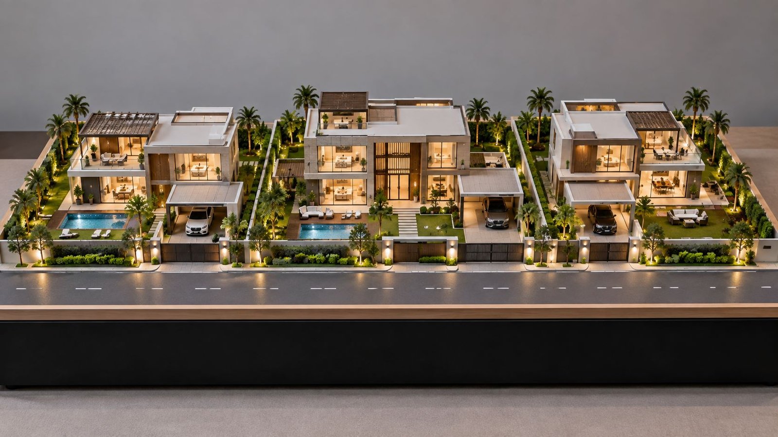
- Premium villas
- Low-rise residences
- Apartment communities
- High-rise residential towers
- Waterfront homes
- Mixed-use residential zones
- Community facilities
- Landscaped neighborhood areas
Showing these different residential types together helps viewers understand how several housing environments can work within one large development.
For architects and developers, a Residential Master Plan Model provides a simple way to explain the relationship between individual neighborhoods and the wider project.
Recreational Spaces and Swimming Pool Areas
Recreational areas add another important layer to the planning concept.
The featured model includes several swimming pool areas within landscaped zones. Residential and hospitality-style developments surround these spaces, creating a connection between buildings and leisure facilities.
The model also includes green spaces, gardens, waterfront recreation areas, and activity spaces.
Instead of placing every recreational facility in one location, the plan spreads these spaces across different parts of the development. This creates a more balanced layout and gives different communities access to leisure areas.
Swimming pools, landscaped courtyards, gathering spaces, gardens, waterfront promenades, and open areas can all form part of a detailed Master Plan Scale Model.
These elements help communicate the lifestyle and community experience that the development aims to create.
Smart City Planning Features
Modern urban planning now looks beyond buildings and roads.
A Smart City Master Plan Model can show connected infrastructure, efficient transportation, sustainable planning, intelligent public spaces, and future-ready development.
The featured model presents a futuristic urban environment through its road network, connected districts, waterfront areas, high-density buildings, landscaped corridors, and public facilities.
A smart city master plan can include:
- Integrated transportation networks
- Connected residential communities
- Smart mobility corridors
- Public green spaces
- Efficient urban circulation
- Mixed-use development
- Future expansion zones
- Recreational infrastructure
- Waterfront development
- High-density urban centers
- Pedestrian-friendly environments
- Sustainable landscape planning
A physical model gives these planning ideas a clear visual form. Stakeholders can then understand how different systems connect within one development.
Bridges and Architectural Connections
Bridges play a major role in the featured model.
Several bridges cross the internal waterways and connect different parts of the development. They support movement while also adding an architectural feature to the urban landscape.
A well-designed bridge can become a visual landmark. Its position, shape, and connection with nearby buildings can influence the character of the entire area.
Bridges also add depth to a physical scale model. They connect the foreground and background and make water-based circulation easier to understand.
This also explains why Engineering Models and Architectural Models often support master planning presentations. Bridges, elevated routes, transportation structures, and public connections can sit alongside buildings and create a complete urban scene.
High-Rise Skyline and Urban Identity
The central skyline forms one of the strongest visual features of the model.
The towers use different heights to create a gradual skyline. The tallest structure forms the main focal point, while the surrounding towers create a dense metropolitan environment.
This arrangement shows how skyline planning can influence the identity of a development.
Architects need to consider the position of high-rise buildings carefully. Their location can affect visibility, density, circulation, waterfront views, public spaces, and the overall appearance of the project.
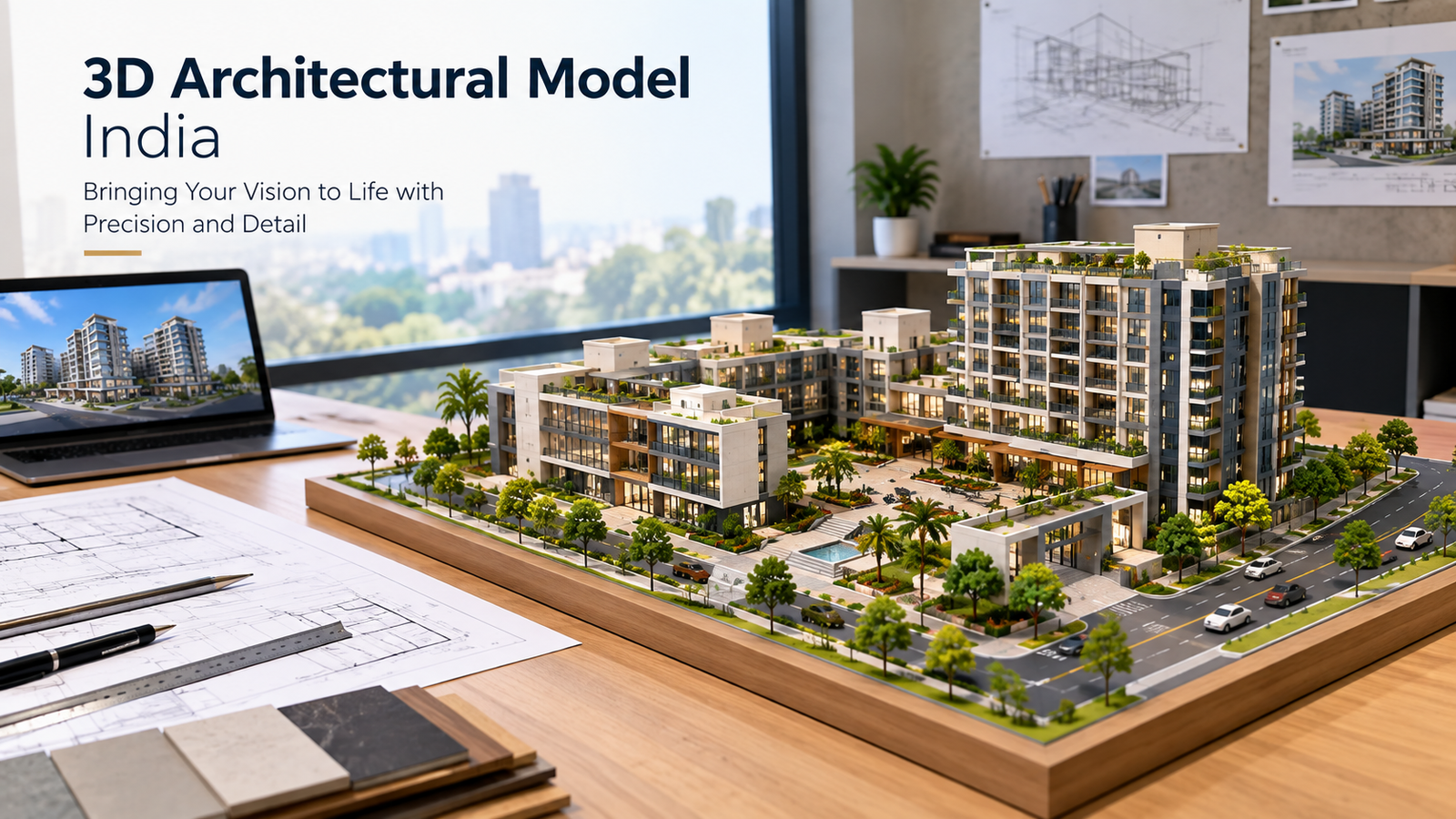
A High-Rise Architectural Model can therefore support a larger master plan presentation.
It allows viewers to study individual tower designs while also seeing how those towers interact with the wider urban environment.
Interior Model and Architectural Presentation
A master plan mainly shows outdoor development, but interior spaces can also play an important role in architectural presentations.
Large developments may contain lobbies, showrooms, reception areas, exhibition halls, commercial spaces, clubhouses, restaurants, and premium residences.
An Interior Architectural Model can show these spaces in greater detail.
For example, a developer can first present the complete master plan and then use an interior model to explain a clubhouse, lobby, commercial area, or premium residential space.
This creates a simple presentation sequence:
Master Plan Model → Building Model → Interior Model
The viewer first understands the complete development. Next, the viewer studies the individual building. Finally, the interior model explains the detailed indoor environment.
This approach works well when a project needs both large-scale planning information and detailed architectural visualization.
Why Physical Models Remain Important
Digital visualization has changed the way architects present projects, but physical scale models still offer a valuable presentation experience.
A physical model allows viewers to see the project from different directions. They can examine individual areas, compare building heights, understand circulation routes, and study the relationship between different zones.
The three-dimensional form also makes project discussions easier.
During a meeting, architects and developers can point directly to specific roads, districts, buildings, landscape areas, or water features. Everyone can use the same physical reference while discussing the project.
A detailed Scale Model Making process therefore supports both visual communication and design discussions.
Detailing That Makes the Model Realistic
Small details create the realistic appearance of a master plan model.
The featured model includes miniature trees, landscaped strips, road markings, street layouts, water channels, bridges, boats, swimming pools, buildings, open spaces, and organized residential clusters.
Together, these details create depth and make the complete environment easier to understand.
For example, a road looks more realistic when the model includes lane divisions, intersections, landscape edges, and nearby buildings. A waterfront becomes more detailed when it includes shorelines, pedestrian areas, boats, bridges, and buildings along the water.
A residential area also becomes easier to understand when the model shows homes, streets, gardens, and shared spaces together.
This shows why a high-quality Architectural Scale Model needs more than building shapes. The surrounding environment also plays an important role.
Presentation Value for Architects and Developers
A master plan model can support many types of architectural and development presentations.
Architects can use it to explain design ideas. Developers can use it to present upcoming projects. Urban planners can use it to explain zoning and connectivity. Design teams can use it during project reviews.
The model can support:
- Client presentations
- Project launches
- Real estate exhibitions
- Design reviews
- Planning discussions
- Investor presentations
- Architectural competitions
- Development proposals
- Marketing displays
- Educational presentations
- Project documentation
Because viewers can see the complete development in one physical view, the model can communicate a large amount of planning information without relying only on multiple drawings.
Master Plan Model as a Design Communication Tool
A major benefit of a master plan model comes from its ability to simplify a complex project.
Large developments involve many planning decisions. Architects and planners need to consider building locations, road alignment, landscape areas, public facilities, water bodies, recreational spaces, and architectural landmarks.
All these elements need to work together.
A three-dimensional model makes these relationships easier to see.
Instead of explaining every part through technical drawings, planners can show the complete development in physical form. Architects, clients, consultants, developers, and project teams can then use the model as a common visual reference.
The model becomes a shared planning language for the project.
Future-Oriented Development Visualization
Future planning plays an important role in modern master planning.
A development needs to show not only its current layout but also how it can grow and change over time.
Flexible districts, expansion areas, connected infrastructure, recreational facilities, mixed-use zones, and improved transportation links can form part of a future planning concept.
A Future City Model can help show how an urban environment may develop over time.
The featured model combines high-density architecture with residential areas, waterfront destinations, transportation infrastructure, recreational spaces, and public areas. Together, these elements create a future-focused urban environment.
This type of visualization helps stakeholders understand the complete development instead of viewing each building as a separate project.
Conclusion
A professionally developed Master Plan Model provides a clear three-dimensional representation of a complete development. It brings architecture, urban planning, landscape design, transportation, recreation, waterfront development, residential communities, public spaces, and future planning into one visual presentation.
The featured model combines high-rise towers, low-rise communities, landscaped neighborhoods, internal waterways, bridges, swimming pools, roads, parks, marinas, recreational areas, and architectural landmarks.
The real value comes from the relationship between these elements.
A tower becomes easier to understand when viewers can see its position within the skyline. A residential area becomes clearer when its roads and landscape connections appear around it. A bridge becomes more meaningful when viewers can see how it connects different districts. A swimming pool, park, waterfront promenade, or public facility also becomes part of a larger story when the model presents it within the complete master plan.
This is where Architectural Model Making, Master Plan Scale Model Making, Urban Planning Models, Interior Architectural Models, and 3D Architectural Visualization come together.
A carefully planned physical model does more than show how a development may look. It also explains how different parts of the project connect and work together.
For complex architectural and urban projects, this visual approach can make presentations clearer, support design discussions, and help different audiences understand the planning concept.
A Master Plan Model creates a strong connection between an architectural idea and its physical representation. It turns a large planning concept into a detailed, understandable, and engaging three-dimensional environment.