Master Plan Architectural Model: A Complete Guide for Large Development Projects
Large development projects require more than just individual building designs. The successful township, residential development, mixed-use, industrial estate, or urban expansion project requires a clear vision of how the different spaces will work together, and it is where a Master Plan Architectural Model becomes an important planning and presentation tool.
A master plan model provides a physical three-dimensional representation of a large development project, depicting a variety of residential, commercial, public, road, land, recreational, and other vital components in one coordinated layout.
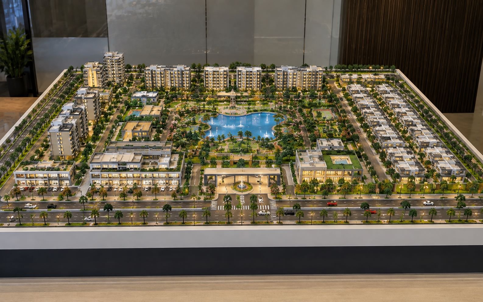
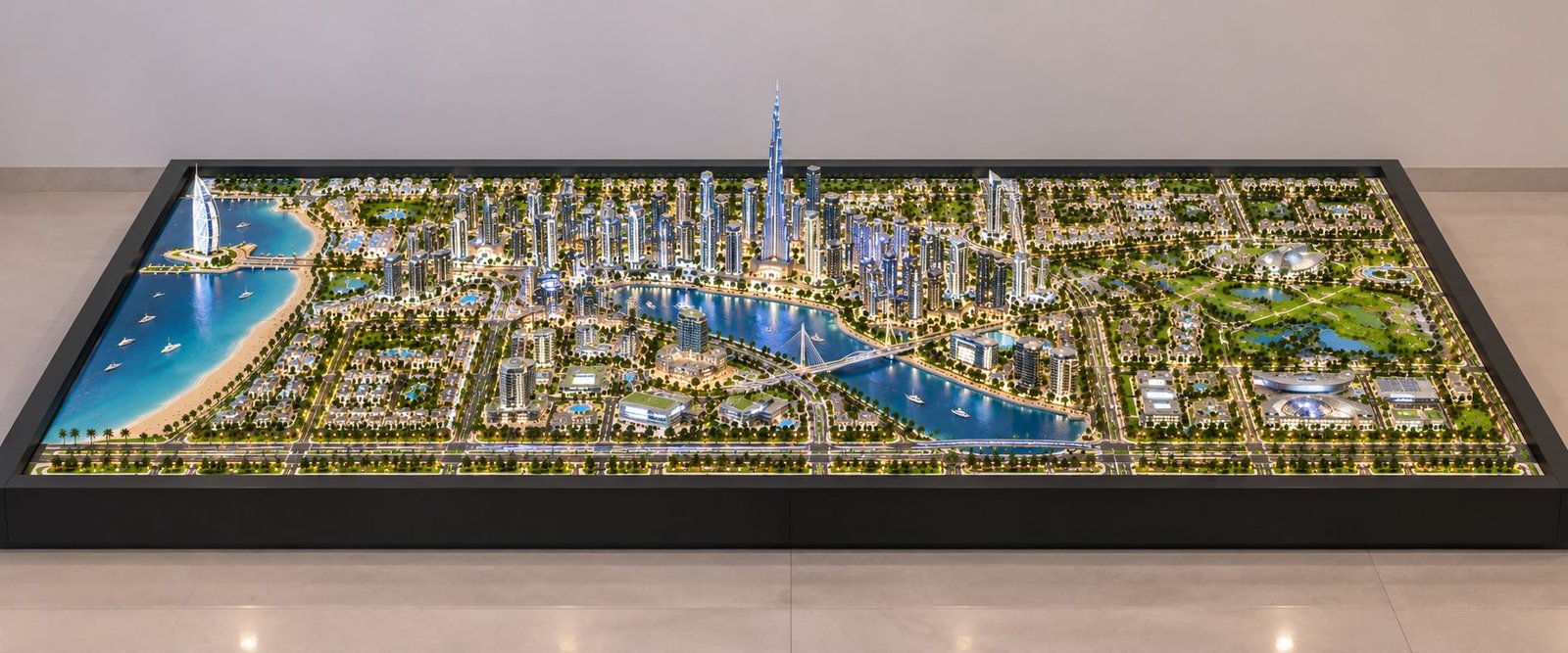
The architectural model shown here is a comprehensive planned development, which displays a variety of land uses consolidated into a single connected community. The wide and relatively low height make the entire site easy to understand from an elevated view, which is ideal for architectural presentation, planning discussions, development proposal, and real-estate projects.
In this guide, we will be looking at the essential components of the master plan architectural model and understand how each of these elements contribute to the overall development.
What Is a Master Plan Architectural Model?
A master plan architectural model is a building model, which represents the overall planning and development of a large site. Unlike a building model, which focuses on a single structure, a master plan model emphasizes the relationship of multiple buildings, infrastructure, open spaces, transportation networks, and community facilities.
The master plan model aims to communicate the complete development concept in a visually understandable form.
For large projects, the drawings and designs can sometimes be difficult for clients, investors, authorities, and non-technical stakeholders to understand, and a physical architectural master plan model can make the proposed development more tangible to them, letting the viewer understand:
- How the site is divided into different zones?
- Where are residential and commercial buildings located?
- How the roads connect different areas?
- Where are the parks and green spaces?
- Where are the public facilities located?
- Where are the water bodies and recreational areas?
- How the pedestrian and vehicular traffic can move through the development?
- How individual buildings contribute to the overall master plan?
Overall site planning
The first and most important feature of this model is the overall site planning.
The whole development is organized on a large rectangular site, which makes multiple zones easy to accommodate in one planned environment. The model does not focus on individual buildings but rather demonstrates how the entire community works as a connected system.
A good master plan design considers land use, circulation, infrastructure, open spaces, environmental features, and future development in a cohesive manner.
The wide format is particularly appropriate for such a large development, as it provides a clear birds-eye view understanding of the project.
Residential zone
The residential zone is one of the main components visible in the model.
Multiple groups of mid-rise residential buildings are arranged in planned clusters along the internal roads with landscaped spaces in between.
This kind of arrangement demonstrates how the residential development can be organized to provide access, greenery, circulation, and community spaces.
A residential master plan may include apartment buildings, residential towers, internal streets, pedestrian pathways, landscaped courtyards, community spaces, parking areas, and green buffers.
In the architectural model, the residential blocks are clearly separated from the central commercial area, creating a logical zoning strategy.
Commercial hub
At the center of the development is a dedicated commercial hub.
The commercial areas are strategically located to provide services to the surrounding residential and public zones, and their central location creates a natural activity center for the planned community.
The commercial zone can represent shopping centers, retail buildings, restaurants, offices, business spaces, mixed-use buildings, public plazas, and pedestrian-friendly streets.
The model demonstrates how the commercial development can become a central destination connected to major roads and residential areas.
Industrial zone
A separate industrial zone is positioned towards one side of the master plan.
The separation of the industrial development from residential areas is an important planning consideration. Depending on the requirements, the industrial areas may need dedicated access roads, service infrastructure, loading areas, and buffer zones.
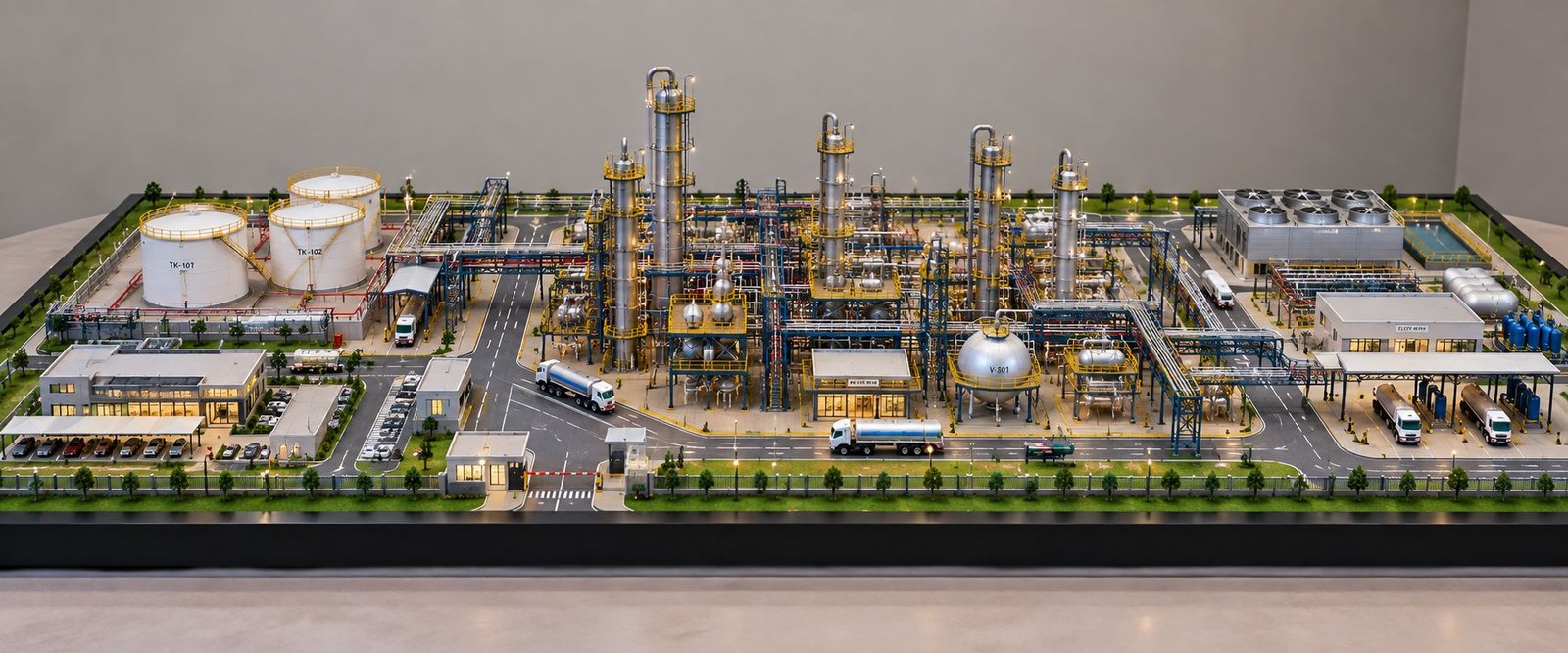
The model uses larger and lower-profile structures to represent industrial development.
A properly designed industrial master plan can include manufacturing facilities, warehouses, logistics buildings, service areas, loading zones, and dedicated transportation routes.
The separation demonstrated in the model helps communicate functional zoning within a large development.
Villa zone
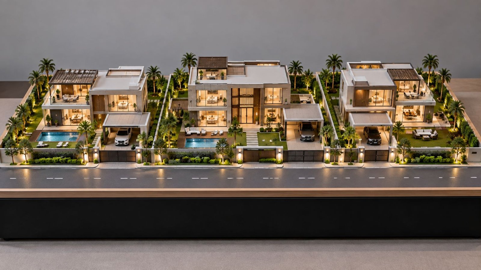
The villa zone provides a lower-density residential component.
Compared with the apartment clusters, the villas occupy a larger individual plot and are arranged around landscaped areas and internal roads, creating a visual difference between the high and low-density housing.
In a real township master plan, different housing typologies can be incorporated to accommodate different lifestyle and market requirements. Besides apartments, villas, and townhouses, different residential formats can co-exist within the same overall development.
Road network and transportation planning
One of the most detailed elements of the model is the road network.
A broad primary road surrounds the development, with secondary roads connecting individual zones, and internal streets providing access to residential buildings, commercial areas, public facilities, and recreational spaces.
Transportation planning is fundamental to every large-scale development.
The road hierarchy shown in a master plan architectural model can represent primary arterial roads, secondary roads, internal streets, roundabouts, junctions, service roads, pedestrian crossings, and parking access.
A clearly defined road hierarchy helps control traffic movement and improves accessibility throughout the development.
Central Boulevard
A prominent central boulevard runs through the middle portion of the development.
The boulevard creates a strong visual and functional spine, connecting different areas, and provides the master plan with a sense of structure and orientation.
Central boulevards can be used as important vehicular routes, but they can also incorporate landscaping, pedestrian pathways, and visual landmarks.
In an architectural presentation model, a central boulevard also helps the viewer understand the project’s primary movement axis.
Roundabouts and major intersections
Several major intersections and roundabouts are incorporated into the model.
Roundabouts can be used to organize vehicle movement at important junctions and create recognizable points within a large development.
The detailed road markings, lane divisions, landscaping, and miniature vehicles make the transportation system easy to understand.
These details are particularly valuable when presenting a large-scale architectural model to clients or planning teams as they have considered the circulation as part of the overall design.
Lake and water feature
A large artificial lake or water body forms one of the most visually prominent features of the master plan.
The blue water surface is surrounded by landscaped areas and recreational pathways, creating a major environmental and leisure element.
Water features can contribute to a development in several ways:
- Visual attraction
- Recreational opportunities
- Landscape enhancement
- Community gathering spaces
- Microclimate benefits
- Project identity
In a physical master plan model, water features are also valuable as they provide an immediate visual reference point within the larger site.
Parks and green spaces
Green spaces are distributed throughout the development, rather than being limited to a single location.
The model includes landscaped parks, tree-lined streets, lawns, gardens, and open recreational areas.
This demonstrates one of the fundamental principles of modern master planning: development should not only consist of buildings and roads but also balance the built up and open spaces.
Green areas can include
- Public parks
- Community gardens
- Landscaped buffers
- Tree-lined avenues
- Walking trails
- Children’s play areas
- Recreational lawns
These spaces improve the visual quality and livability of the planned community.
School and educational facility
A dedicated school and educational facility is located towards the front-left section of the model.
The school includes a large green sports field, demonstrating that educational planning goes beyond the classroom building.
A complete township development often requires educational infrastructure to reduce travel distances for residents.
The educational zone can include school buildings, sports grounds, play areas, assembly spaces, drop-off zones, pedestrian access, and landscaped surroundings.
Its location along an accessible road makes it easy to understand how public facilities can be integrated into the overall development.
Hospital and healthcare facility
The model also includes a dedicated hospital and healthcare facility towards the front-right section.
Healthcare facilities are an essential component of large residential and mixed-use developments; their location and accessibility are important considerations during master planning.
The hospital is visually identifiable through its larger institutional structure and medical signage.
A healthcare zone within a master plan may include hospital buildings, emergency access, visitor parking, service access, landscaped areas, and pedestrian connections.
Including healthcare infrastructure in a township architectural model demonstrates that the development is planned as a complete community rather than just a collection of buildings.
Recreational areas
Recreational spaces are integrated around the lake, parks, and landscaped zones.
Walking paths, open lawns, gardens, and gathering areas create opportunities for residents and visitors to use the outdoor environment.
Modern master plan architecture increasingly emphasizes recreational planning, as public spaces significantly contribute to community interaction and quality of life.
These areas can include
- Walking tracks
- Cycling paths
- Outdoor seating
- Children’s play areas
- Sports facilities
- Community gathering spaces
- Landscaped gardens
Landscape design
Landscape design is visible throughout the model.
Trees line the major roads, residential areas, parks, and site boundaries. Smaller landscape elements are also placed around individual buildings.
This creates a green framework around the built environment.
In a professional architectural master plan model, landscaping helps communicate not only where vegetation is proposed, but how the development will feel as a finished environment.
Landscape planning can include
- Tree plantations
- Shrub planting
- Lawns
- Garden spaces
- Green buffers
- Avenue plantations
- Waterfront landscaping
Pedestrian connectivity
Although vehicles occupy a significant portion of the road network, pedestrian movement is also represented through pathways and landscaped corridors.
Pedestrian connectivity is essential in a modern development, as people should be able to move safely between homes, parks, commercial areas, schools, and recreational facilities.
A well-designed master plan therefore considers both vehicular and pedestrian circulation.
Building clusters and urban density
The model demonstrates different building densities across different zones.
The residential sector contains repeated mid-rise building clusters, while the villa zone uses lower-density development. Commercial buildings occupy a more concentrated central area while industrial buildings are larger and more spread out. This variation demonstrates how urban planning models can communicate density and land-use relationships visually.
Building height, spacing, orientation, and clustering all influence the character of a master-planned development.
Site boundary and green buffer
The outer boundary of the model is lined with trees and landscape elements.
A site boundary can serve practical as well as visual purposes. Green buffers may provide separation from surrounding roads, neighboring properties, or different land-use zones.
In a physical model, the boundary also helps the project area to be defined clearly.
Miniature vehicles and human-scale details
Small cars and other scale elements are placed throughout the road network.
These details may seem unimportant, but they are extremely useful in an architectural scale model, as they help the viewer understand the proportions of roads, buildings, parking spaces, and public areas.
Scale figures, vehicles, trees, street furniture, and other miniature elements transform an abstract plan into a recognizable physical environment.
Master plan legend and zoning information
A professional master plan presentation benefits from clear zoning information.
The model includes a legend, which distinguishes major categories such as residential, commercial, industrial, public facilities, green areas, water bodies, and road networks.
A legend is particularly useful when a project contains multiple land-use categories, as it allows the viewer to quickly understand the planning strategy without studying every individual building.
North direction and site orientation
The model also includes a compass, which indicates the site’s orientation.
Orientation is an important part of architectural planning, as the position of buildings and open spaces can influence sunlight, ventilation, views, circulation, and environmental performance.
Including a north indicator in the master plan architectural model, makes the presentation more technically complete.
Why Master Plan Architectural Models Are Important
A master plan model is more than a miniature version of a development; it is a communication tool, which allows architects, planners, developers, investors, government authorities, and clients to visualize the project as a complete system.
The model can help with:
- Project presentations
- Client approvals
- Investor presentations
- Real-estate marketing
- Urban planning discussions
- Architectural exhibitions
- Development proposals
- Design coordination
- Public consultation
For large projects, this visual communication can make complex planning concepts significantly easier to understand.
Materials Used for a Master Plan Model
A professional architectural master plan model can be constructed using different materials, depending on the required level of detail and presentation quality.
Common materials include
Acrylic sheets, MDF, foam board, PVC sheets, acrylic rods, printed textures, resin components, 3D-printed elements, artificial grass, miniature trees, transparent materials for water features, LED lighting systems, and more.
The choice of material will depend on the project scale, budget, required durability, and presentation purpose.
Scale in a Master Plan Architectural Model
Scale is one of the most important technical considerations.
A large development may contain roads, buildings, parks, infrastructure, and landscape elements, which are spread across a very large site, and therefore, the model must use a scale, which provides a sufficient amount of detail, while keeping the complete project manageable.
Common architectural model scales can vary, depending on the size and purpose of the project.
The selected scale should allow important features to remain visible, without making the model excessively large.
Master Plan Model for Real Estate Projects
Real-estate developers frequently use master plan models to present large residential and mixed-use developments.
A physical model can help potential buyers understand:
- Apartment locations
- Road connectivity
- Parks
- Clubhouses
- Commercial areas
- Schools
- Healthcare facilities
- Waterfront features
- Green spaces
- Future development areas
This makes a real estate architectural model an effective marketing and communication asset.
Master Plan Model for Urban Development
For urban development projects, the model can become even more comprehensive.
It may incorporate transportation infrastructure, public buildings, residential neighborhoods, commercial districts, industrial areas, recreational zones, and environmental systems.
The wide format shown in this model is particularly appropriate for presenting a large urban development, as the viewer can see the complete relationship between different zones from a single viewpoint.
Conclusion
A Master Plan Architectural Model provides a detailed physical representation of how a large development project is organized. The model shown here demonstrates the complete planning approach by combining residential buildings, commercial development, an industrial zone, villas, roads, roundabouts, a central boulevard, parks, landscaping, a lake, recreational areas, a school, a hospital, pedestrian pathways, and other supporting infrastructure.
Each component has a specific role in creating a functional and visually coherent development.
The residential zone provides housing, the commercial hub creates an activity center, the industrial zone supports employment and production, while schools and healthcare facilities provide essential public services. Parks, green corridors, landscaping, and the lake, introduce environmental and recreational value. Meanwhile, the road network and pedestrian connections, tie the entire project together.
This is the key advantage of a master plan architectural model: it allows an entire development strategy to be understood as one connected environment, rather than as a collection of drawings.
For architects, urban planners, developers, and real-estate professionals, a well-designed master plan model can communicate scale, zoning, connectivity, density, landscape strategy, and future development potential in a highly visual and accessible way.
Whether it is used for a township, residential community, mixed-use development, industrial estate, urban expansion, or large real-estate project, a detailed architectural master plan model, remains one of the most effective ways to present the vision of a large development project.